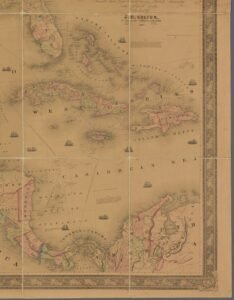
Historic map collections have long been treasures for historians, genealogists and planners — beautiful, detailed and frustratingly locked in image files. Over the past few years, a quiet infrastructure build has begun: automated georeferencing, optical text extraction and linkages to modern gazetteers are converting scanned sheets into map layers, searchable text and downloadable GeoJSON. The result is practical: you can now overlay a 1923 Sanborn insurance sheet on modern streets, search scanned atlases for place names, or call an API that serves a tiled historic map layer for your web map.
Three parallel advances
Three kinds of work have combined to make this possible. First, large cultural institutions have digitized and published their map collections at scale. Second, automated georeferencing and stitching tools place map sheets on modern coordinates. Third, machine‑learning pipelines extract and link the text on maps to modern datasets so a map’s content becomes queryable.
Sanborn maps, automatically placed
The Library of Congress hosts the largest public collection of Sanborn fire insurance maps and has made the scans widely available as a digital collection and as an open data package. A volunteer‑built project called mapsnap reads the street names on each Sanborn sheet and matches them to modern OpenStreetMap geometry, producing overlays you can view and download. The mapsnap project reports placing more than 30,000 Sanborn volumes — 343,403 individual sheets — across 7,820 towns and cities, turning static plates into layerable historic basemaps that anyone can explore or reuse. ([loc.gov](https://www.loc.gov/collections/sanborn-maps/about-this-collection/?utm_source=openai))
Large collections get georeferenced and served
Private and public map collections are adding georeferencing tools and APIs. The David Rumsey Map Collection offers a georeferencer and multiple viewers that let users overlay historic maps on Google Maps or Google Earth, and the collection supports programmatic access and IIIF delivery for high‑resolution images. National libraries such as the National Library of Scotland (NLS) provide hundreds of thousands of zoomable historic maps and an active program of scanning and georeferencing; the NLS says its map images site hosts over 400,000 historic maps and runs an annual program that adds around 30,000 new scans each year, plus a Historic Maps API for tiled layers. Those services let researchers and local governments pull historic map layers into modern GIS tools without having to georeference sheet by sheet. ([davidrumsey.com](https://www.davidrumsey.com/view))
From words on maps to linked data
Even when a sheet sits in the right place on the globe, its content — the printed street names, mills, wharves and field names — has remained locked in pixels. New pipelines change that. The research system mapKurator demonstrates a full end‑to‑end approach: it slices large map scans, runs text‑spotting models, converts image coordinates to geocoordinates and links recognized labels to external knowledge bases such as OpenStreetMap or Wikidata. The mapKurator team reports having processed over 60,000 maps and more than 100 million text/place names in the David Rumsey collection as part of pilot work that makes map labels searchable and exportable in GeoJSON. ([arxiv.org](https://arxiv.org/abs/2306.17059))
What this means in practice
- Family historians can overlay period maps on their modern street to locate a house footprint, wharf or parcel as it once stood, without manual alignment.
- Researchers can full‑text search map labels across tens of thousands of sheets instead of eyeballing thumbnails, speeding place‑name studies and urban change analysis.
- Urban planners and conservationists can extract historical land use and infrastructure layers to inform restoration, flood‑risk research or heritage designation.
Because many institutions publish both images and georeferenced layers under open terms, these data are now reusable in mapping libraries (Leaflet, OpenLayers), desktop GIS (QGIS) and web services. That lowers the technical bar for local groups, researchers and startups to combine historic evidence with modern sensors and models.
Still work to do
Automated methods are powerful but imperfect. Text recognition on ornate cartographic fonts, faded ink or non‑Latin scripts still needs human review; georeferencing multi‑sheet atlases can create small distortions where sheets were drawn at different times or with different projections; and licensing nuances remain for some scanned material. Many projects intentionally combine automatic processing with crowd correction interfaces so volunteers can validate and fix outputs — a pragmatic pairing of machine speed and human judgment.
But the practical payoff is clear: instead of locked image galleries, historic maps are becoming interoperable, addressable and discoverable data layers. For anyone who has ever wanted to see “what this street looked like in 1910” in a single click, that future is already here.
Where to try it
- See Sanborn plates overlaid on today’s streets via the mapsnap project and the Library of Congress Sanborn collection. ([mapsnap.org](https://mapsnap.org/))
- Explore georeferenced historic layers and the NLS Historic Maps API for Ordnance Survey layers covering the 1920s–1940s. ([data.nls.uk](https://data.nls.uk/tools/maps-and-tools/))
- Read technical details and demos of mapKurator’s text extraction and linking work on the David Rumsey collection. ([arxiv.org](https://arxiv.org/abs/2306.17059))
These projects don’t just make the past prettier on a screen — they turn centuries of cartography into data that can be measured, queried and combined with modern maps. That unlocks new questions about how places change, and who lived where, with a speed and scale that would have been impossible a decade ago.