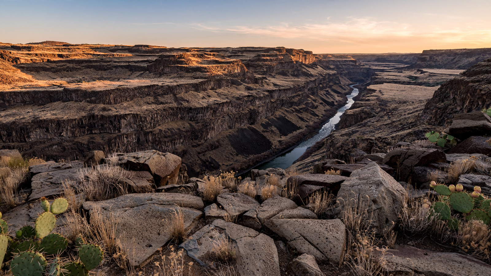
On a map, Agua Fria National Monument can look like an empty space between the Phoenix metropolitan area and Prescott. On the ground, it is anything but empty.
The monument’s high-desert mesas, steep canyons and seasonal waterways hold one of central Arizona’s richest archaeological landscapes. Stone pueblos, agricultural terraces, rock art and traces of older trails remain scattered across more than 72,000 acres of public land in Yavapai County. The setting is rugged and often quiet, but it is not a blank wilderness. It is a place shaped by water, wildlife and many generations of human life.
That combination gives Agua Fria its particular character. It is not a single ruin arranged for easy viewing, nor a landscape defined by one dramatic overlook. Its importance lies in the way many pieces remain connected: the river and its tributaries, the mesas above them, the plants and animals that use the canyon country, and the archaeological evidence left by people who learned how to live in a dry and changeable environment.
A national monument built around a river
President Bill Clinton established Agua Fria National Monument by proclamation in January 2000. The Bureau of Land Management manages the monument as part of the agency’s National Conservation Lands system.
The monument follows a section of the Agua Fria River and includes two broad plateaus, numerous side canyons and a landscape that changes noticeably with elevation. Near the river, the terrain can feel enclosed and rough. On the mesas, open grasslands and stands of juniper create a wider horizon. Basalt-capped formations give parts of the monument a dark, layered appearance, while the river corridor provides a thread of greener vegetation through the surrounding desert.
Water is not abundant here, and that is part of the story. The Agua Fria is a seasonal river in much of its course, responding to winter storms and summer monsoon rain. Its flow has helped cut the canyons, sustain riparian habitat and make the surrounding country useful to both people and wildlife. In an arid region, even an intermittent river can organize an entire landscape.
The monument is also part of a larger ecological transition zone. Sonoran Desert influences meet higher-elevation grasslands, pinyon-juniper woodland and riparian communities. That variety creates habitat for animals including mule deer, javelina, coyotes, mountain lions and many bird species. The river corridor can serve as a particularly important refuge in a landscape where shade and dependable water are limited.
A landscape full of places, not just artifacts
Federal land managers and archaeologists have documented more than 450 archaeological sites within Agua Fria National Monument. Some date back roughly 2,000 years, while many of the best-known settlements were occupied during the late prehistoric period, particularly between about A.D. 1250 and 1450.
Those dates do not describe one uniform culture or a single community. They describe a period when people across the Southwest built settlements, farmed difficult ground, exchanged materials and adapted to changing conditions. At Agua Fria, the evidence is distributed across the mesas and canyon country rather than concentrated in one monumental center.
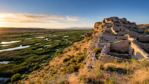
Among the most notable places is Pueblo La Plata, a large settlement on a mesa overlooking the surrounding country. Its stone rooms and walls show that the high ground was not merely a temporary lookout. People invested labor in architecture, storage and community space. Elsewhere, smaller sites, field systems, terraces and check dams reveal the practical work of producing food in a dry environment.
The archaeological record also includes petroglyphs, chipped-stone tools, pottery fragments and other evidence of daily activity. Taken together, these traces offer a more complete picture than a single preserved building could provide. They suggest where people lived, how they moved through the country, how they managed water and soil, and how communities were connected to the wider region.
It is important to approach that record with care. The sites are not abandoned curiosities waiting to be collected. They are cultural places, protected by law and meaningful to Indigenous peoples whose histories extend far beyond the dates visible in a park brochure. Removing pottery, stones or other objects damages the archaeological record and can make it impossible to understand how a site functioned.
Why the mesas mattered
At first glance, the mesas of Agua Fria may seem like difficult places to build a settlement. Their edges can be steep, their soils thin and their water sources separated by rough terrain. But elevation also brought advantages.
From a mesa, residents could see across broad sections of the landscape. The high ground offered defensible locations, cooler conditions than the lowest desert valleys and access to different plant communities. Flat or gently sloping areas could support fields, while nearby drainages provided routes between settlements and access to water after storms.
Archaeology does not provide a complete narrative of what happened to every community in the monument. It does, however, show that people were making deliberate choices about location and resources. The settlements were part of a landscape system, not isolated piles of stone.
That perspective changes the way the monument is experienced today. A visitor looking across Perry Mesa is not simply seeing a scenic view. The open grassland contains signs of old walls and fields that can be difficult to notice at first. The absence of a modern building does not mean the absence of history. In many places, the most important evidence is subtle.
Public land with a light footprint
Agua Fria’s remoteness helps protect its archaeological character, but it also makes visiting more demanding than visiting a developed park. Many roads are unpaved, conditions can change quickly, and some sites require cross-country travel. There are limited facilities compared with a national park, and cellular coverage may be unreliable.
Those limitations are part of the monument’s value. A low-development landscape makes it possible to encounter the mesas, dark skies and canyon sounds with relatively little infrastructure between the visitor and the setting. It also places more responsibility on visitors.
The Bureau of Land Management advises people to plan carefully, carry plenty of water, check weather and road conditions, and use durable routes where they exist. Summer heat and monsoon storms can create serious hazards. Flash flooding is possible in narrow drainages, and even a short outing can become difficult when temperatures rise or a vehicle leaves a maintained road.
Respect for the archaeological record is equally important. Visitors should leave artifacts and rocks where they are, avoid climbing on walls, keep vehicles on designated routes and refrain from making new trails or marks. Photographs can preserve a memory without removing anything from the place itself.
A different kind of Arizona landmark
Arizona is often introduced through its most recognizable landscapes: the Grand Canyon, red-rock formations, desert cities and historic mining towns. Agua Fria offers a quieter version of the state’s story. Its significance is not based on one famous viewpoint. It comes from the relationship between a river, a high plateau and a dense record of human adaptation.
That makes the monument especially valuable as the region around it changes. Central Arizona continues to grow, and the open lands north of Phoenix are increasingly close to major roads and expanding communities. Protecting a large, connected landscape preserves more than scenery. It safeguards wildlife movement, watershed functions, dark skies and archaeological sites that cannot be replaced once disturbed.
The monument also gives visitors a chance to practice a more patient form of looking. A wall partly hidden by grass, a line of stones following a slope or a patch of unusually level ground may seem ordinary until its relationship to water, soil and neighboring sites becomes clear. Understanding Agua Fria requires time, restraint and attention to details that do not announce themselves.
In that sense, the monument is a kind of high-desert archive. Its pages are spread across mesas and canyons rather than bound in a building. Some are written in masonry, some in the shape of old fields, and some in the continuing movement of water through the river corridor.
Agua Fria National Monument does not preserve a vanished world sealed away from the present. It protects a living landscape where ecological and human histories remain layered together. The result is one of Yavapai County’s most important places: not because it has been made simple for visitors, but because it has been allowed to remain complex.