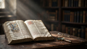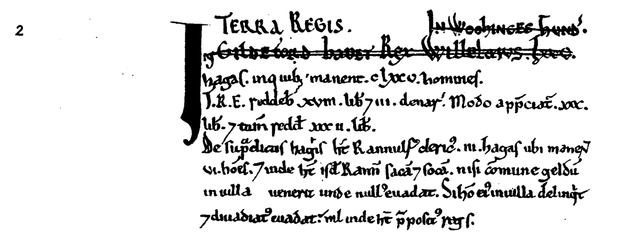
In 1086, officials working for William the Conqueror produced an unusually ambitious account of England: a survey of who held land, what that land contained and what it was worth. The record became known as the Domesday Book. It was not a complete census or a modern map, but it made a vast amount of local information available to a central government—and, centuries later, to historians studying life after the Norman Conquest.
Its importance lies partly in its scale. Instead of describing the kingdom as a single landscape, the survey broke it into places, estates and claims of ownership. It captured a society in which land was the main source of wealth and political power, and made those relationships easier for the crown to inspect.
A kingdom turned into questions
William, who had taken the English throne in 1066, ordered the survey in the mid-1080s. The project was carried out in 1086. Royal commissioners gathered information across much of England, drawing on local knowledge and asking questions about land and its holders. The inquiry sought, among other things, to establish who had held estates before the Conquest and who held them now, as well as their extent, value and resources.
Those comparisons gave the record a political edge. The change from the reign of Edward the Confessor to William’s rule had brought a sweeping redistribution of land. By setting earlier and current ownership alongside one another, the survey documented that transformation in terms the king’s administration could use.
Entries also noted features that mattered economically: plough teams, mills, fisheries, woodland and other resources, along with taxable or productive land. The precise details vary from place to place. The book is a snapshot of what the commissioners recorded, not a uniform inventory in which every estate has exactly the same information.
Two books, not one neat ledger
What people call the Domesday Book is made up of two volumes, known as Great Domesday and Little Domesday. Despite the names, Little Domesday is not simply a shorter summary. It contains fuller entries for Essex, Norfolk and Suffolk. Great Domesday covers most of the other surveyed counties in a more compressed form.
The survey did not cover every part of what is now England. Some northern areas were outside its reach, and some major towns were not included in the same way as the surveyed counties. That uneven coverage matters: the book is extraordinarily rich, but it cannot stand in for every community or every person who lived in the country.
Nor is it a population register. Its concern was primarily land, lordship and value. People appear in categories linked to the land and its work, but many individuals are not named. Historians can use the record to study settlement and social structure, while also remembering that its purpose was administrative rather than to count everyone for their own sake.
Why “Domesday”?
The name carries a sense of final judgment. It was applied later, in the 12th century, reflecting the idea that the book’s findings were authoritative and difficult to challenge—like the Last Judgment. The title was not the survey’s original working label. Its familiar name therefore tells us something about how later generations viewed the document: not merely as a list, but as a lasting statement of rights and obligations.
That reputation should not be mistaken for modern completeness or neutrality. The record was produced for a ruler’s administration. It organized information through the priorities of power: who possessed an estate, what it could yield and what claims might be made upon it. Its silences are part of its history too.
A reference work for the present
For historians, the Domesday Book is valuable because it preserves evidence from a period for which detailed written records are scarce. It can help researchers trace place-names, compare estates, investigate landholding and see how communities were described by royal officials. A single entry may offer clues about a mill or a stretch of woodland; patterns across entries can reveal larger shifts in ownership and wealth.
But reading it requires care. Medieval measurements and terms do not always translate neatly into modern ones, and a written valuation is not the same as a direct measurement of everyday prosperity. A village’s entry reflects what the survey captured and how its compilers classified the information. It cannot tell us everything about the people whose lives sat behind those categories.
That tension is part of what makes the book compelling. It is both a tool of government and a source historians can use to ask questions its makers may not have intended. The survey set out to make England’s land and obligations more knowable to the crown. Nearly a millennium later, its pages still offer an unusually detailed route into the workings of a medieval kingdom—provided readers notice not only what was recorded, but also what the record leaves out.