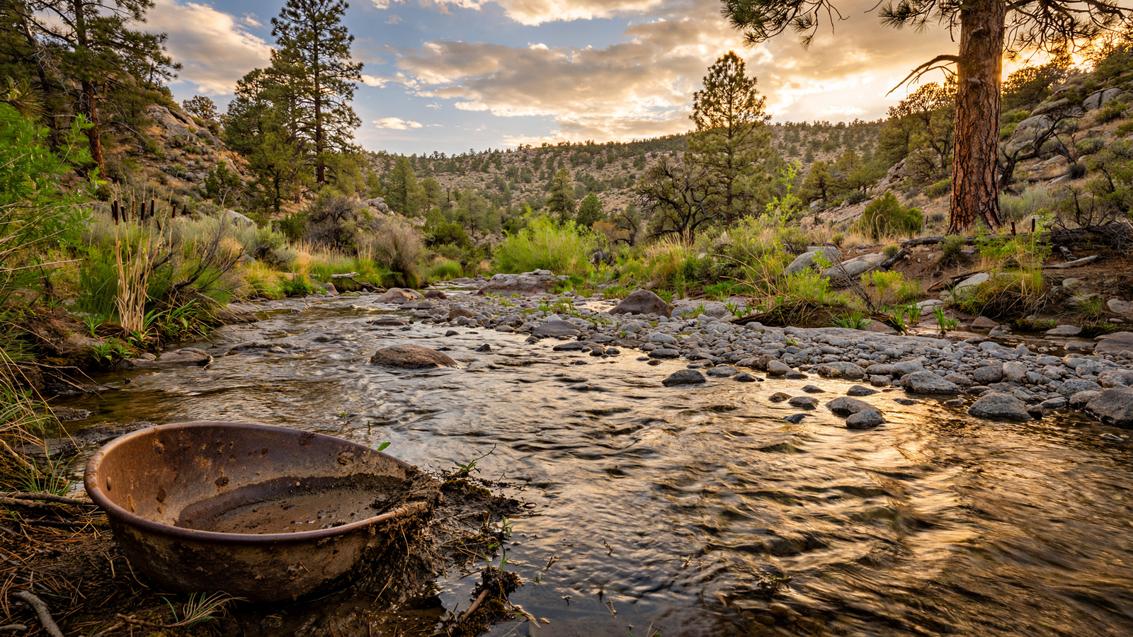
East and southeast of Prescott, beneath ponderosa pines and along a landscape shaped by granite, lies a waterway with an outsized place in Arizona history. Lynx Creek is not one of the state’s famous rivers. In many places, it is a modest mountain stream, changing character with the season and the weather. But in the 1860s, its gravel bars helped bring a new rush of people into central Arizona.
The creek became associated with placer gold, the kind of gold carried and concentrated by moving water. Miners worked the streambed and nearby drainages by hand, washing sediment in pans, rockers, and sluices. Their efforts helped establish one of the earliest mining districts near Prescott and connected the area to the wider territorial history of the American West.
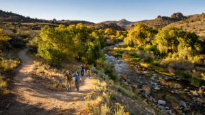
That past is still visible, but Lynx Creek is not simply a historic backdrop. Its forests, riparian pockets, roads, trails, and public lands continue to provide space for hiking, wildlife, outdoor recreation, and quiet exploration. The result is a place where geological history and human history remain unusually close together.
A creek at the edge of a new territory
Arizona’s central highlands were not an empty wilderness when American prospectors entered the region. Indigenous communities had long known and traveled through the landscape, using its water sources, plants, game, and passageways. The arrival of miners and military expeditions in the 1860s brought a different kind of attention: one focused on finding mineral wealth and establishing permanent settlements.
Gold discoveries along Lynx Creek are generally dated to the early 1860s, around the same period that Prescott was founded as the territorial capital. The creek’s placer deposits were important because they could be worked with relatively simple equipment. Unlike deep hard-rock mining, placer mining begins with loose material already broken down from the surrounding geology. Water then becomes the tool that separates heavier gold from lighter gravel and sand.
The process was labor-intensive and often environmentally disruptive. Miners moved streambed material, diverted water, cut into banks, and searched for small particles of gold caught in cracks and bends. The traces of that work became part of the terrain, while the broader mining economy encouraged roads, supply businesses, camps, and new settlements.
Lynx Creek was part of a larger network of early gold sites in the Prescott region, including tributaries and nearby drainages. Its significance was not only the amount of gold recovered. The creek helped make the surrounding mountains economically legible to newcomers and contributed to Prescott’s emergence as a center of government, commerce, and transportation.
Why placer gold gathered there
The story of Lynx Creek begins with the rocks above it. The Prescott area sits within a geologically complex part of central Arizona, where older crystalline rocks, volcanic formations, and faulted mountain terrain have been shaped by erosion over long periods of time.
Gold released from mineralized rock can be carried downhill by streams. Because gold is dense, it tends to settle where water slows: behind obstructions, in cracks in bedrock, along inside bends, and in layers of gravel. Over time, repeated floods and changes in the channel can concentrate that material in pockets that attract prospectors.
This helps explain why a small creek could become a major destination. The waterway did not need to be large. It needed the right combination of source rocks, erosion, channel shape, and accessible sediment. In the early mining era, a pan and a shovel were enough to test whether a gravel bar might repay the effort.
The landscape after the rush
Mining did not end when the first rush faded. Gold seekers returned to the region in different waves, and small-scale prospecting continued in parts of the Prescott area for decades. Some operations expanded beyond hand tools, while others remained seasonal or limited to individuals and small groups.
As the region developed, Lynx Creek became part of a broader mountain landscape that supported ranching, timber work, transportation, and recreation. The creek’s history therefore does not fit neatly into a single boom-and-bust story. It is better understood as one thread in the making of a high-country community.
Today, the surrounding public lands are managed primarily for a mixture of conservation and public use. The Prescott National Forest includes extensive forests and watersheds around the city, with roads, trails, campgrounds, and dispersed recreation areas. Conditions vary widely by season, and some routes are rough or weather-dependent, but the area remains accessible enough for visitors to see how closely Prescott’s outdoor identity is tied to its working landscape.
A place where history is often underfoot
One of Lynx Creek’s most interesting qualities is that its history is not concentrated in a single building or monument. It is spread through the land. A road may follow an old route between mining areas. A flat patch beside the creek may reflect earlier human use. A pile of altered rock or an artificial-looking channel may hint at past efforts to move water and sediment.
That does not mean every unusual feature is a mining relic. Natural erosion, road construction, wildfire, grazing, and modern recreation have also changed the landscape. Visitors should avoid disturbing artifacts, digging into historic sites, or collecting objects from public land. Archaeological and historic materials are protected, and even seemingly ordinary pieces can lose much of their meaning when removed from their original setting.
The better way to read Lynx Creek is slowly. Look at where the water runs after a storm. Notice the difference between a natural bank and a reshaped one. Pay attention to the transition from open gravel to willow, cottonwood, or other vegetation near wetter ground. These details show how water has continued to organize the landscape long after the first prospectors arrived.
More than a mining story
Gold can dominate the popular history of central Arizona, but it is not the only story Lynx Creek carries. The watershed is part of a larger high-desert and mountain ecosystem where seasonal water supports plants and animals that cannot live on the surrounding dry slopes alone.
Riparian areas—bands of vegetation associated with streams—are disproportionately important in arid regions. They provide shade, cover, food, and travel routes for wildlife. Even a narrow creek corridor can create a noticeable ecological change, especially during the hot and dry parts of the year.
The creek also helps explain why Prescott’s surrounding public lands matter beyond scenery. Forests and drainages provide a setting for recreation, but they also function as connected systems. Water moves through them, wildlife moves across them, and past land-use decisions remain visible in the way the ground looks today.
Preserving a layered place
Lynx Creek does not offer a polished historical experience with a single entrance, a reconstructed street, or a carefully arranged collection of objects. Its appeal is more open-ended. Visitors encounter a living watershed that happens to contain an important chapter in Arizona’s territorial history.
That kind of place requires a different form of preservation. Protecting the creek means caring for water quality, vegetation, wildlife habitat, historic traces, and the public access that allows people to learn from the landscape. It also means recognizing that recreation can affect the same resources it celebrates. Staying on established routes, respecting seasonal closures, and following forest regulations are practical ways to keep the area available for future visitors.
For Prescott, Lynx Creek offers a reminder that the city’s history did not begin and end around its courthouse square. It extends into the surrounding mountains, where geology created the opportunity, water concentrated the minerals, and people built an economy around what they found.
The gold is no longer the main reason to visit. The deeper reward is seeing how one modest creek connects Prescott’s geology, settlement history, public lands, and outdoor life. Lynx Creek remains a place where the past has not been placed behind glass. It is still part of the ground, the forest, and the moving water.