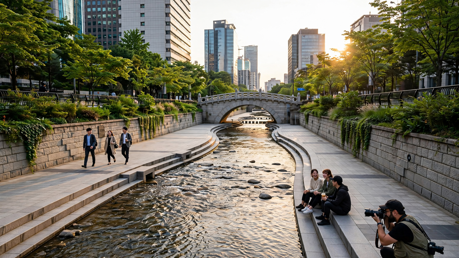
In the middle of Seoul, a ribbon of water now runs between stone paths, trees, bridges and busy commercial districts. People walk beside it, sit near its banks and cross it on their way through the city. It feels like a natural feature—but for decades, the Cheonggyecheon was hidden beneath concrete.
The stream’s transformation is one of the clearest examples of a city reclaiming space from automobiles. Between 2003 and 2005, Seoul removed an elevated roadway and sections of the road surface that had covered the waterway. The restoration created a public corridor stretching about 5.8 kilometers through the heart of the capital.
From open stream to urban highway
The Cheonggyecheon was once part of everyday life in Seoul. As the city industrialized after the Korean War, however, the stream was gradually covered. Roads were built above it, and an elevated highway was completed over the corridor in the 1970s.
The structure helped carry traffic through a rapidly growing city, but it also divided neighborhoods and contributed to a harsh, heavily paved downtown environment. By the early 2000s, the highway was aging. Seoul faced a choice familiar to many cities: repair a major piece of road infrastructure or reconsider what the space was for.
The city chose removal. The project was not simply a matter of uncovering an untouched river. Much of the water in the restored channel is managed and supplemented as part of an engineered urban system. The achievement was therefore less a return to an unaltered past than an effort to build a functioning public landscape around a historic waterway.
A different kind of transportation project
Taking away a major road raised concerns about congestion. Seoul responded with changes to bus service, traffic management and nearby streets. The result offered a practical lesson: removing road capacity does not automatically make a city impossible to navigate, although the effects depend on the wider transportation network and on how people adapt.
The restored corridor gave pedestrians something that the highway could not: a continuous place to move slowly. Its paths connect offices, markets, transit stations and cultural destinations. Bridges and access points bring surrounding neighborhoods down to the water, turning what had been a barrier into a route through the city.
The project also changed the local environmental experience. Replacing a broad expanse of asphalt and concrete with water, planting and shaded paths helped create a cooler corridor than the surrounding road environment. Researchers and city officials have studied changes in temperature, air quality, habitat and pedestrian activity, while also noting that the stream requires ongoing maintenance and controlled water management.
Why the project still matters
Cheonggyecheon became a reference point for urban planners around the world because it joined several goals in one intervention: historic recovery, public space, ecological improvement and transportation reform. Its influence can be seen in the growing interest in “daylighting” buried waterways and converting traffic infrastructure into parks, plazas and walking routes.
There is no single template hidden in Seoul’s example. The project required substantial public investment, careful traffic planning and long-term management. A restored stream cannot by itself solve a city’s housing, pollution or mobility problems.
But Cheonggyecheon demonstrates a powerful possibility. A city can look at a familiar piece of infrastructure—not as something permanent, but as a decision that can be revisited. In Seoul, space once devoted almost entirely to moving cars became a place where the city could meet itself again.