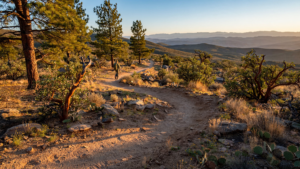
On the north side of Prescott, the land opens in a way that feels larger than the city around it. Granite outcrops rise beside a broad trail. Juniper and pinyon cast broken shade across the ground. Beyond them, the water and rocky shoreline of Watson Lake catch the changing light. For related reading, see The Peavine Trail: How an Old Railroad Grade Became One of Prescott’s Open-Air Rooms.
The route through this landscape is the Peavine Trail, one of Yavapai County’s clearest examples of how an old transportation corridor can acquire a second public life. What once served as a railroad grade now gives people a relatively gentle way into the high desert—on foot, by bicycle, with a dog on a leash, or simply at the pace required to notice the place. For related reading, see The Tucson Loop: How a Desert Trail Became Part of Everyday Life.
That transformation is more than a recreational convenience. The trail connects Prescott’s urban edge to a landscape shaped by granite, grassland, water, and working transportation history. It also shows why former rail corridors have become valuable civic spaces: their grades are often broad and manageable, their routes connect destinations, and their history remains visible under the modern use. For related reading, see Prescott Lakes: Where a Planned Community Leaves Room for the High Desert.
A route shaped by an older kind of travel
The Peavine follows the general alignment of a former railroad route north of Prescott. The corridor’s name preserves that earlier identity, even though the trains are gone and the surface now belongs to nonmotorized travel.
Rail lines were built for a practical reason: they needed steady grades and workable routes across difficult terrain. Those same characteristics make many abandoned rail beds useful for trails. Instead of climbing sharply over the landscape, the path tends to move gradually, allowing visitors to cover ground without the technical demands found on steeper mountain routes.
That does not make the Peavine an ordinary sidewalk. Its surroundings quickly become unmistakably high desert. The trail passes through open country where the vegetation is widely spaced and the sky is part of the experience. Granite formations give the route a strong visual identity, while seasonal changes alter the balance between sun, shade, dust, and green growth.
The result is a place where transportation history and landscape experience overlap. A visitor can follow a route created for trains while seeing a terrain that long predates the railroad and continues to shape Prescott’s daily life.
Why the trail feels accessible
The Peavine is especially important because it offers access without requiring every visitor to be an experienced backcountry traveler. The trail’s former rail alignment provides a comparatively broad and moderate route, making it useful for a range of abilities and activities.
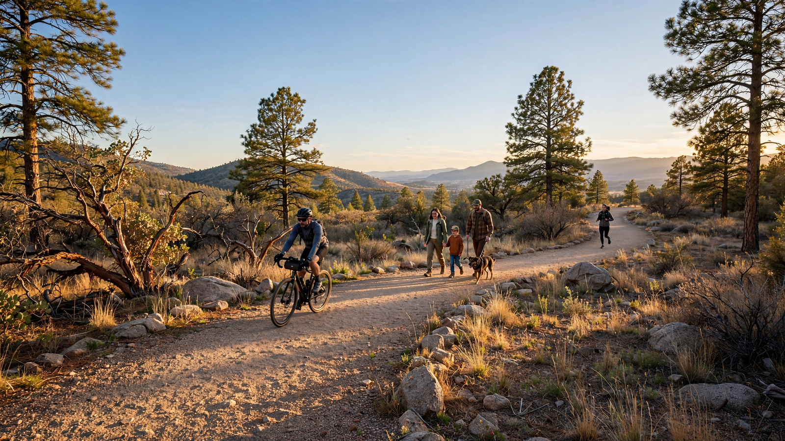
People use it for short outings and longer excursions. Some come to walk beside the granite country near Watson Lake. Others ride bicycles, run, photograph birds, or use the route as a starting point for exploring the wider trail network. Because visitors can turn around whenever they choose, the experience does not have to be an all-day commitment.
That flexibility matters in a community where public open space serves many purposes at once. A trail can be a destination for recreation, a setting for informal exercise, a way to introduce children to the outdoors, and a low-cost place to spend time with friends. The Peavine manages to support all of those uses without requiring a reservation or specialized equipment.
It also gives people a more gradual transition from town to open country. The change is not abrupt. Buildings and roads remain part of the larger setting, but the trail creates enough distance and continuity for the landscape to become the main subject.
Watson Lake is part of the story
The Peavine’s relationship with Watson Lake helps explain its popularity. The lake and its surrounding granite formations are among Prescott’s best-known public landscapes, and the trail gives visitors a way to experience them without viewing the area only from a road or a single overlook.
Water is never a minor detail in the high desert. Its presence changes the appearance of the landscape and creates habitat for birds and other wildlife. Around Watson Lake, the combination of water, exposed rock, shrubs, and open ground produces a setting that feels both rugged and unusually accessible.
The trail also reveals how a place can be valuable even when it is not untouched. Watson Lake is managed for public use, and the Peavine itself is a constructed route with a transportation history. Yet the area still provides moments of quiet and contact with the larger ecological patterns of central Arizona.
That balance is one reason public trails deserve to be understood as more than exercise facilities. They are viewing platforms, habitat edges, history lessons, and everyday gathering spaces. Their success depends on making room for people while preserving enough of the surrounding character for the place to remain recognizable as a landscape.
A trail with several speeds
One of the Peavine’s strengths is that it does not dictate a single way to move. A cyclist may cover a long section in an hour or two. A runner may use it as part of a training route. A family may walk only a short distance before stopping to examine a rock or watch the light change across the lake.
Those different speeds can coexist when visitors remain attentive to one another. The trail is shared public space, not a private track for one activity. Yielding, keeping dogs controlled, and allowing room for people traveling in both directions are small actions that protect the route’s welcoming character.
The same principle applies to the landscape. Staying on the established route helps reduce damage to fragile soil and vegetation. Packing out trash protects the experience for the next visitor and prevents waste from reaching drainage channels or wildlife. In a dry environment, even modest disturbances can remain visible for a long time.
These habits may seem ordinary, but they are part of what keeps an accessible place accessible. The Peavine works because many people can share it without each person treating it as if they are alone.
Public land close to home
Prescott is surrounded by public land, but proximity still matters. Not everyone has the time, transportation, or equipment to reach a remote trailhead. A route near the city can offer many of the benefits of outdoor recreation while remaining available for a spontaneous walk after work or a short weekend outing.
The Peavine also helps connect the idea of conservation with ordinary routines. A person does not need to plan a major expedition to experience open country. The trail makes the high desert part of daily civic life, which can strengthen public interest in maintaining trails, protecting water, and caring for the surrounding forest and rock country.
That role becomes increasingly important as communities grow. Development can make open space feel fragmented, even where large protected areas remain nearby. Connected trails provide a form of continuity: they let people move through the landscape and recognize relationships between neighborhoods, water, vegetation, and public land.
The Peavine is not a substitute for wilderness, and it was never intended to be. Its value lies elsewhere. It is a public corridor where history, recreation, and landscape meet at a scale people can use regularly.
Reading the landscape along the way
A walk on the trail rewards attention to small transitions. The ground may shift from pale dust to stone. A stretch of open vegetation may give way to a darker stand of trees. Granite appears first as isolated boulders and then as larger formations that define the horizon.
Wildlife sightings are never guaranteed, but the mix of water and upland habitat gives the area ecological variety. Birds may be easier to notice near the lake or in quieter sections of the route. Even without seeing an animal, visitors can observe tracks, calls, changing vegetation, and the way water influences the surrounding terrain.
The railroad past is also part of what visitors are reading. The level route, the engineered corridor, and the direction of travel all carry traces of a system built for a different economy and a different era. Reusing that alignment does not erase its history. It allows the public to encounter it through movement rather than through a museum case alone.
Why the Peavine matters now
The Peavine Trail represents a practical kind of civic success. It does not depend on creating a new attraction from scratch. Instead, it makes an existing corridor useful again and links it to one of Prescott’s defining natural settings.
Its importance is visible in the variety of people who can use it: residents looking for a nearby walk, visitors exploring Watson Lake, cyclists seeking a longer route, and families introducing children to the high desert. Each group encounters a different version of the trail, but all depend on the same basic achievement—the preservation of a continuous public path through a changing landscape.
In Yavapai County, where communities are separated by mountains, desert, forest, and long stretches of open country, that continuity has real value. The Peavine shows how a place built for one kind of movement can become a shared resource for another. Its most lasting contribution may be the simple invitation it offers: slow down, follow the old line across the land, and see how much remains connected.
Planning a visit
Visitors should check current City of Prescott and Prescott National Forest information before setting out, since access, parking, weather, and seasonal conditions can change. The route is exposed in places, so water, sun protection, and appropriate footwear are sensible choices. Cyclists and pedestrians share the trail, and visitors should follow posted rules, stay on designated routes, and respect the shoreline and surrounding vegetation.
Use: Trail setting, access, route character, and recreational uses.
Use: Watson Lake’s public recreation setting and relationship to Prescott’s granite landscape.
Use: Public-land recreation guidance and trail-use context in the Prescott area.
Use: Independent trail reference and former rail-corridor context.
City of Prescott — Peavine Trail — https://www.prescott-az.gov/recreation-area/peavine-trail/ — Trail setting, access, route character, and recreational uses.
City of Prescott — Watson Lake Park — https://www.prescott-az.gov/recreation-area/watson-lake-park/ — Watson Lake’s public recreation setting and relationship to Prescott’s granite landscape.
Prescott National Forest — Recreation and Trails — https://www.fs.usda.gov/r03/prescott/recreation/trails — Public-land recreation guidance and trail-use context in the Prescott area.
Rails-to-Trails Conservancy — Peavine National Recreation Trail — https://www.traillink.com/trail/peavine-national-recreation-trail/ — Independent trail reference and former rail-corridor context.