In Tucson, a trail does not have to lead to a summit, a scenic overlook or a remote stretch of desert to feel like an adventure. Sometimes it leads to work, school, a grocery store, a library or the next neighborhood. For related reading, see Goldwater Lake: How Prescott Keeps a Mountain Reservoir Part of Everyday Life.
That is the quiet achievement of the Chuck Huckelberry Loop, a large network of paved paths built along the region’s rivers and washes. Known locally simply as “The Loop,” it now extends for more than 130 miles through and around the Tucson metropolitan area. It is one of the country’s largest shared-use path systems—and one of the clearest examples of how a place can make everyday movement feel more open. For related reading, see The Peavine Trail: How Prescott Turned a Railroad Grade Into a High-Desert Commons.
The Loop is not one continuous trail in the narrow sense. It is a connected system of routes along the Santa Cruz River, Rillito River, Pantano Wash, Julian Wash and Cañada del Oro Wash. Some sections feel urban and busy. Others pass through cottonwoods, open desert, farmland and broad flood-control corridors where the city suddenly seems far away. For related reading, see Watson Woods: The Prescott Preserve Where a Desert Creek Still Makes Room for Life.
What binds those different landscapes together is the path itself: mostly paved, separated from automobile traffic and built for more than one kind of traveler.
A flood-control system became a public landscape
The Loop’s origins are practical. Tucson’s rivers and washes are also important flood-control channels, especially during the summer monsoon. For decades, those corridors were treated primarily as infrastructure—places designed to move stormwater safely through a rapidly growing desert region.
But the same corridors offered something cities often struggle to find: long, relatively uninterrupted stretches of public land. By adding paths, bridges and connections, Pima County and its municipal partners turned flood-control space into a regional landscape.
That transformation matters because it does not depend on creating a new park from scratch. The Loop uses land that already runs through the metropolitan area. A wash that might otherwise be experienced only as a concrete channel or a dry strip of desert becomes a route between communities.
The result is a different way of understanding Tucson’s geography. The city is not only a collection of roads branching outward from a center. It is also connected by watercourses—some seasonal, some engineered, all shaped by the desert’s relationship with rainfall.
One route, many ordinary purposes
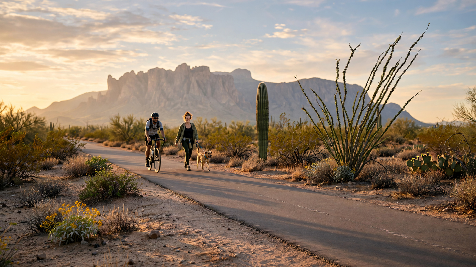
On a typical day, people use The Loop for reasons that do not look especially dramatic. Runners train along the Rillito. Families ride bicycles beside the Santa Cruz River. People walk dogs, push strollers and meet friends at trailheads. Road cyclists use the long, relatively flat stretches for training. Visitors rent bikes and sample a section without committing to a full-day excursion.
That variety is part of the system’s strength. A trail designed only for recreation can be easy to dismiss as an amenity. A path that links parks, neighborhoods and commercial areas becomes more like public transportation for short trips—even if most users are walking or riding for pleasure.
The Loop also gives people a way to cross parts of the region without entering traffic. The route is not a substitute for a complete transit network, and not every destination is directly accessible from it. Still, a protected, paved connection can change the practical distance between places. A trip that would feel unsafe or unpleasant along a busy arterial may become manageable when it follows a wash.
That is especially important in a metropolitan area where heat, wide roads and low-density development can make short-distance travel difficult. The Loop cannot solve those challenges by itself. But it provides a piece of infrastructure that works for people who are walking, bicycling or simply looking for a route through town that is not dominated by cars.
The desert is part of the experience
The Loop’s appeal is not only its usefulness. It also reveals Tucson’s natural character at a human pace.
Along parts of the Santa Cruz River, cottonwood and willow trees create shade and habitat. Near the Rillito, the channel and surrounding paths form a long green seam through the city. Other sections are more stark, with views of dry washes, mesquite, saguaros and distant mountains. The landscape changes with the season: summer storms can briefly transform normally dry channels, while winter brings cooler air and longer stretches of comfortable daylight.
Those variations make the system feel less like a single recreational facility and more like a collection of neighborhood landscapes. A person riding from one end to another can move through dense urban areas, open agricultural land and desert corridors without leaving the same broad network.
The path also offers a close view of the region’s water story. Tucson’s washes may be dry most of the year, but they are not empty. They carry stormwater, shape flood risk, support vegetation and mark the routes through which the desert responds to rain. In that sense, The Loop follows not just lines on a map but some of the physical logic of the Sonoran Desert.
Connections matter more than landmarks
Many celebrated places are defined by a single feature: a building, a monument, a viewpoint or a distinctive natural formation. The Loop is different. Its value accumulates through connections.
A bridge over a wash may not be memorable on its own. A trailhead may look modest. A short segment between two roads may seem unremarkable. But each connection makes the larger system more useful. The experience is similar to a local street grid: no single block explains the whole city, yet the network changes how people move through it.
The Loop’s connections extend across several jurisdictions, including Tucson, Marana, Oro Valley and unincorporated parts of Pima County. That regional character is one reason the trail feels larger than a conventional city park. It crosses boundaries that are obvious on a government map but less important to someone following the path.
It also creates a shared civic space for people who may not otherwise have much in common. A commuter on a bicycle, a retired couple walking after breakfast, a child learning to ride and a visitor exploring the city can all use the same corridor. They do not need the same destination or the same speed to share the place.
Designing for a hot-climate city
Using The Loop well requires desert awareness. Shade is uneven, summer temperatures can become dangerous, and long distances between access points can be more significant than they appear on a map. Water, sun protection, timing and route planning are not optional details during the hottest months.
Those conditions also show why the trail system is more than a recreational convenience. In a hot-climate city, public spaces have to be evaluated by how people can actually use them. A path that is comfortable in January may require careful planning in July. Trees, rest areas, nearby water, lighting and safe crossings all influence whether a route is genuinely accessible.
The Loop’s continued usefulness depends on that practical work: maintaining pavement, improving crossings, protecting vegetation, adding signs and making trail access easier to understand. A regional path is never finished simply because the route exists. Its everyday value comes from steady attention to the details that let people return safely and confidently.
A different idea of what a city park can be
Tucson is often introduced through its iconic desert scenery, but The Loop presents another kind of local identity. It shows a city making room for movement, informal gathering and contact with nature inside the metropolitan landscape.
Its most important contribution may be that it lowers the threshold for outdoor life. A person does not need specialized equipment, a long drive or a reservation to use it. One can enter near home, walk for twenty minutes, continue for several miles or build an entire day around the route.
That flexibility makes The Loop a genuinely everyday place. It belongs to the weekend cyclist, but also to the neighbor taking an evening walk. It belongs to visitors, but it is not merely a tourist attraction. It is a regional asset whose meaning comes from repeated use.
In the desert, connection is never accidental. Water finds channels. Plants gather where conditions allow. Roads and neighborhoods follow the shape of the land, even when development tries to flatten it. The Chuck Huckelberry Loop adds another kind of connection—one made for people, following the washes and rivers that have always helped organize life in Southern Arizona.
Its achievement is easy to miss because it is so practical. The Loop does not need to be spectacular every day. It only needs to keep giving people a way to cross Tucson, encounter the desert and share a public landscape on their own terms.
Use: Official overview of the Chuck Huckelberry Loop, including its regional trail network, route corridors and recreational uses.
Use: Municipal information on Tucson access, trail use and the Loop’s role as a shared-use public path.
Use: Regional transportation-planning context for walking, bicycling and active-transportation connections in Southern Arizona.
Pima County — The Loop — https://www.pima.gov/parks/parks_and_recreation/the_loop/ — Official overview of the Chuck Huckelberry Loop, including its regional trail network, route corridors and recreational uses.
City of Tucson Parks and Recreation — Chuck Huckelberry Loop — https://www.tucsonaz.gov/Departments/Parks-and-Recreation/Parks/Chuck-Huckelberry-Loop — Municipal information on Tucson access, trail use and the Loop’s role as a shared-use public path.
Pima Association of Governments — Active Transportation — https://azmag.gov/Programs/Transportation-Planning/Active-Transportation — Regional transportation-planning context for walking, bicycling and active-transportation connections in Southern Arizona.