Arizona is often described through extremes: the hottest lowlands, the highest mountains, the deepest canyon, the driest stretches of desert. The Arizona Trail does something different. Rather than separating those landscapes into isolated destinations, it joins them in a single north–south passage running roughly 800 miles from the Mexican border to the Utah line.
The trail is not a paved greenway or one uninterrupted strip of public land. It crosses federal forests, national parks, state lands, municipal areas, private property, and remote desert country. Some sections are complete and well established; others depend on continuing work to improve routes, secure access, and protect the trail experience. Its achievement is therefore less about a single construction project than about a long-running act of cooperation.
That makes the Arizona Trail more than a route for backpackers. It is a way to read the state as a connected ecological and cultural landscape.
A trail imagined as a whole state
The idea emerged in the 1980s, when Arizona hiker and teacher Dale Shewalter began envisioning a long-distance trail that would cross the state from south to north. At the time, Arizona already had many memorable paths, but they were generally understood as separate experiences: a canyon trail here, a mountain route there, a desert walk somewhere else.
The Arizona Trail proposed a different scale. Its purpose was to link existing landscapes and communities into one nonmotorized corridor, allowing people to move through the state’s major geographic transitions on foot, horseback, or bicycle where appropriate.
The Arizona Trail Association, a nonprofit created to support the project, helped turn the concept into a practical public effort. Volunteers, land managers, trail crews, local governments, and partner organizations gradually worked out a route that could cross an extraordinarily varied state without becoming a conventional highway through nature.
In 2009, Congress designated the Arizona Trail as a National Scenic Trail. That status placed it within the National Trails System alongside other nationally significant long-distance routes. The designation recognized both the trail’s recreational value and its role in connecting important natural and cultural landscapes. For related reading, see Willow Creek Reservoir: How a Prescott Waterway Became a Quiet Place for Wildlife and Everyday Life.
Eight hundred miles of change
Following the Arizona Trail from south to north is almost like watching a landscape evolve in fast motion.
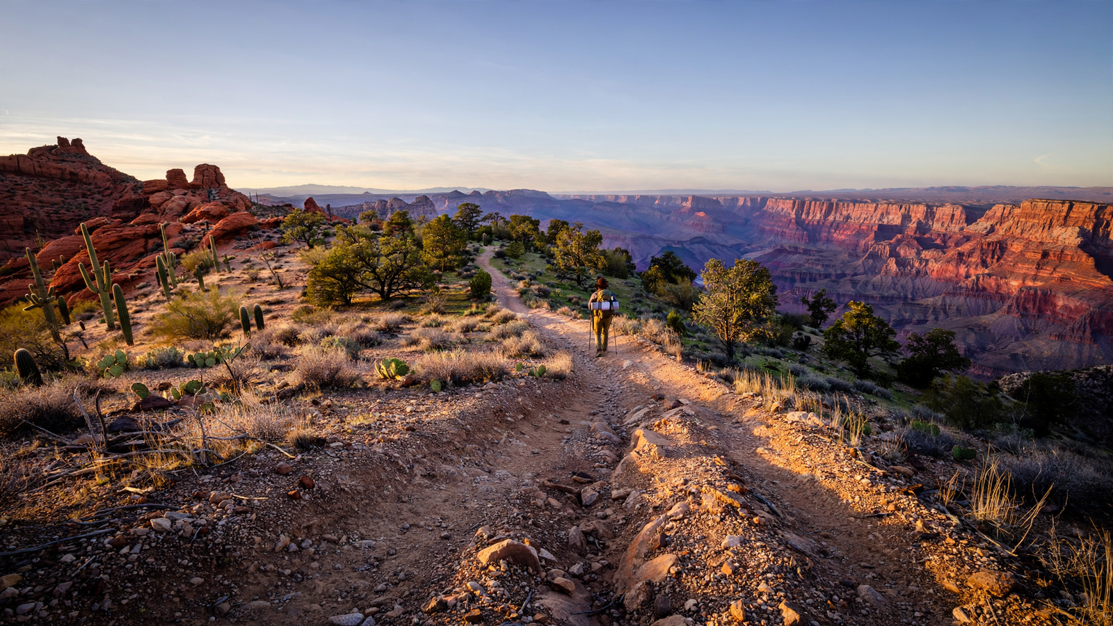
Near the international border, the route passes through Sonoran Desert country, where thornscrub, cactus, seasonal washes, and wide horizons define the experience. Farther north, it climbs toward the sky islands and mountain ranges of southern Arizona. These isolated highlands create cooler, wetter habitats surrounded by desert—a pattern that helps explain why the state can support such a remarkable variety of plants and animals within relatively short distances.
The trail continues through grasslands, pine forests, volcanic terrain, and high-elevation country. It crosses the Mogollon Rim, follows portions of the Colorado Plateau, and reaches the Grand Canyon before continuing toward the Utah border. Each section has its own climate, geology, hazards, and visual language.
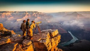
The route’s most famous landscape is also one of its most demanding. The Grand Canyon is not simply a dramatic viewpoint along the way; it is a major change in elevation and terrain. A long-distance traveler must account for steep descents and climbs, limited water, heat, exposure, and the physical reality that a landscape can be beautiful and difficult at the same time.
That variety is central to the trail’s meaning. A desert wash, a ponderosa pine forest, and a canyon rim may appear unrelated when visited separately. Connected by one route, they become chapters in the same story about water, elevation, fire, geology, and adaptation.
The work behind the line on the map
Long trails can look finished on a map long before they are simple on the ground. The Arizona Trail’s route includes remote stretches, road crossings, changing access conditions, and sections where the best path has required years of negotiation and maintenance.
Building and sustaining the trail involves tasks that rarely make dramatic photographs: clearing brush, repairing tread, replacing signs, checking passages after storms, monitoring erosion, and helping travelers understand where public access begins and ends. In some places, the work also means finding a better alignment so that the trail avoids sensitive habitat, unsafe roads, or conflicts with other land uses.
The Forest Service and other public agencies manage portions of the route, but no single agency owns the entire project. That fragmented ownership is a challenge, yet it is also why the Arizona Trail serves as a useful model of shared stewardship. Its continuity depends on people and institutions that may have different responsibilities but a common interest in keeping the route open and understandable. For related reading, see Lynx Lake: How a Prescott Mountain Reservoir Became an Everyday Escape.
Volunteers are particularly important. Trail organizations can coordinate crews, organize events, document conditions, and build public support, but the physical work still has to be done section by section. The finished experience is therefore the visible result of thousands of smaller contributions.
A corridor for more than recreation
The Arizona Trail was created for human travel, but its broader value comes from the way it makes ecological connections visible.
Wildlife does not recognize the boundaries between a national forest, a national park, and a county. Water moves downhill across ownership lines. Fire, drought, invasive species, and changing temperatures affect whole watersheds and mountain ranges rather than one jurisdiction at a time.
The trail is not automatically a wildlife corridor in every segment, and its presence does not solve the state’s larger conservation challenges. Still, by following major landforms and linking protected areas, it gives the public a continuous way to understand how those places relate. A traveler can experience the shift from desert to forest not as an abstract map, but as a physical progression measured in miles, shade, elevation, and changing plant communities.
That perspective matters in a state where development and transportation infrastructure can divide habitats. Protecting a long-distance route requires attention to crossings, easements, adjacent land uses, and the quality of the surrounding landscape. Even where the trail itself is narrow, the decisions around it can encourage a wider view of conservation.
Public land, public memory
The Arizona Trail also crosses a human landscape shaped by Indigenous communities, ranching, mining, transportation, settlement, and recreation. A trail cannot tell all of those histories by itself, and no single interpretive sign can represent the full meaning of every place it crosses. But its length makes one fact difficult to ignore: Arizona’s landscapes have never been empty.
The route passes near archaeological sites, historic transportation corridors, working landscapes, and communities whose relationships with the land long predate the trail. Responsible travel requires respecting closures, private property, cultural resources, and tribal sovereignty. It also requires resisting the idea that a scenic route exists only for the people passing through it. For related reading, see Granite Basin Lake: How a Small Prescott Reservoir Makes Room for Desert Life.
In that sense, the Arizona Trail is best understood as a public invitation with obligations attached. It offers access, but asks visitors to prepare carefully, carry adequate water, follow regulations, limit impacts, and leave room for the people and wildlife already connected to the landscape.
The value of a long view
Most outdoor infrastructure is experienced in fragments. A person walks a loop trail, visits a viewpoint, or spends an afternoon beside a lake. The Arizona Trail adds another possibility: seeing a state through continuity.
That continuity changes the scale of attention. On a short outing, a dry wash may seem like an obstacle. Over hundreds of miles, seasonal water becomes one of the central facts of the region. A stand of tall pines is not just scenery; it is evidence of elevation and climate. A steep canyon is not merely a landmark; it is part of the geological process that shaped the surrounding plateau.
The trail turns those connections into something a person can feel. It makes geography personal without making it small.
Its most hopeful achievement is not that every mile is easy or every problem solved. It is that a route imagined decades ago has become a durable public project, maintained through patience, partnership, and repeated attention. In a time when landscapes are often discussed as isolated assets or threatened fragments, the Arizona Trail offers a different idea: that the spaces between famous places matter, too.
From the borderlands to the high country near Utah, the trail gives Arizona a long thread to follow. Along the way, it connects recreation with stewardship and scenery with responsibility. The result is a public landscape that is not finished once and for all, but kept alive by the people willing to walk it, care for it, and understand it as one connected place.
Use: Primary organizational source for the trail’s route, history, stewardship work, volunteer program, and visitor information.
Use: Federal source for the trail’s National Scenic Trail designation, route, management context, and public-land connections.
Use: Authoritative background on the National Trails System and the role of National Scenic Trails.
Use: State source for Arizona Trail background and its relationship to Arizona’s public recreation system.