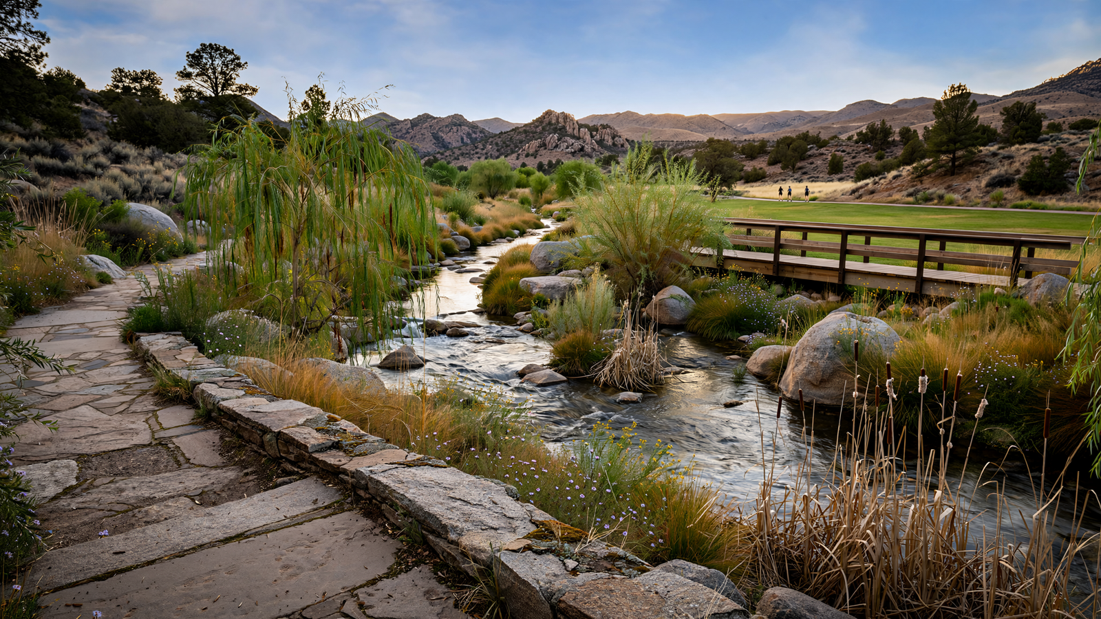
In Prescott, some of the city’s most important public places are not grand squares or landmark buildings. They are the landscapes that make ordinary movement possible: a path to walk after dinner, a strip of cottonwoods beside a creek, a patch of open ground where stormwater can spread without overwhelming nearby streets.
Granite Creek is one of those places. It runs through the Prescott area as part of the high-desert drainage system, carrying water away from the surrounding mountains and neighborhoods toward the Agua Fria watershed. For much of the year, it can look modest—more seasonal channel than dramatic river. But its importance becomes clear whenever a strong summer storm sends water through the basin.
The city’s Granite Creek corridor work is an effort to treat that waterway as more than a drainage problem. The broader vision connects flood protection, habitat, trails, parks, and neighborhood access. It is a distinctly Prescott kind of project: practical at its foundation, but capable of making the city feel more generous and more connected.
A creek with several jobs to do
Urban creeks often occupy an awkward position. They are essential to the movement of stormwater, yet they can be overlooked when a community thinks about parks and public life. In a growing mountain town, a creek corridor also has to absorb pressure from roads, homes, utilities, recreation, and changing weather patterns.
Granite Creek sits at that intersection. Its channel and surrounding floodplain help move water through Prescott, while the vegetation along portions of the corridor provides shade and cover for birds and other wildlife. The same corridor can also offer a relatively gentle route for people moving through the city on foot or by bicycle.
That combination makes the creek unusually valuable. A conventional drainage project might focus only on moving water quickly. A conventional park project might focus mainly on lawns, fields, or amenities. A corridor approach asks whether one landscape can do several things at once without losing its natural function.
Prescott’s planning documents describe the Granite Creek area as a connected system rather than a single isolated park. That distinction matters. A short path or improved park parcel can be useful on its own, but a series of linked public spaces can change how residents experience the city. It can make a creek visible again, create safer routes between neighborhoods, and turn a landscape people once passed by into a place they intentionally visit.
Why floodplain planning can improve a city
Floodplains are sometimes treated as empty land waiting for development. In reality, they are working landscapes. They give high water somewhere to go, slow the movement of runoff, and can provide room for plants and wildlife that do not thrive on paved ground.
Keeping that function in view is especially important in Arizona, where heavy rain can arrive in short, intense bursts. The region’s summer monsoon storms may be brief, but they can produce fast-moving water in normally quiet channels. A creek corridor designed with water in mind can reduce the temptation to force every part of the landscape into a rigid, heavily engineered shape.
This does not mean that every flood risk disappears. It means that public investment can work with the geography instead of pretending the geography is not there. Parks, trails, bridges, vegetation, and drainage improvements can be planned together, with safety as the first requirement and public access as an additional benefit.
The result is not necessarily spectacular in the way a new building is spectacular. Its success may be measured in less visible ways: water remaining within an intended corridor, paths staying usable, vegetation surviving difficult seasons, and residents having a route that feels more comfortable than walking beside a busy road.
The public value of a connected landscape
Prescott already has a strong reputation for trails and outdoor access, but the Granite Creek corridor serves a different purpose from a destination such as a mountain lake or a forest trailhead. It is closer to the city’s everyday life.
A neighborhood-scale corridor can support short walks, informal observation, dog walking, exercise, and small moments of contact with nature. It does not require a special trip, a long drive, or a full afternoon. For older residents, families with young children, and people who do not have easy access to a car, that proximity can determine whether outdoor recreation is genuinely available.
It can also provide a different kind of civic space. A trail beside a creek does not ask people to participate in the same way a sports field or organized event does. People can use it alone or together, for five minutes or an hour. That low-pressure quality is part of what makes linear parks valuable. They offer a public place without requiring a scheduled activity.
When several segments are linked, the corridor can become a piece of transportation infrastructure as well as recreation infrastructure. Residents may be able to combine a walk or bicycle ride with errands, school travel, or access to other parks. That is a modest but meaningful shift: open space becomes part of how the city works, not merely something placed at its edge.
A habitat corridor in a developed setting
Granite Creek is not an untouched wilderness, and a city corridor should not be described as one. Roads, buildings, crossings, utilities, and regular maintenance all shape the landscape. Still, even an urbanized waterway can provide ecological value when its channel and banks retain some natural character.
Native and adapted vegetation can stabilize soil, offer shade, and create cover for birds and small animals. Pools and damp areas that appear after rain may be temporary, but temporary water can still matter in an arid environment. A connected corridor also gives wildlife more than a collection of isolated patches, even if the connection is imperfect.
The ecological benefits depend on careful maintenance. Invasive plants, erosion, trash, altered flows, and excessive clearing can reduce what a creek corridor is able to do. The strongest version of the project is therefore not simply a paved trail beside a channel. It is a public landscape managed with an understanding of water, soil, vegetation, and seasonal change.
That approach is consistent with the larger water realities facing Prescott. The Prescott Active Management Area is one of Arizona’s designated groundwater-management regions, and state water planners have long treated growth and water supply as connected questions. A creek corridor cannot solve a regional water challenge, but it can encourage a more complete understanding of water: not only what comes from a tap, but also how rain moves across the land and where it belongs.
Why the work takes time
Projects like this rarely arrive as one finished object. A corridor is assembled through property decisions, engineering studies, environmental review, funding cycles, design work, construction, and long-term maintenance. Different sections may advance at different speeds, and the final experience may remain uneven for years.
That gradual process can be frustrating when residents want immediate improvements. It can also be an advantage. A phased project allows the city to learn from each section, adjust designs, protect sensitive areas, and coordinate trail or drainage work with other infrastructure. It creates opportunities for public input before every decision has been locked into place.
The challenge is to preserve a coherent purpose while individual pieces move forward. A new path should eventually make sense as part of a larger network. A park improvement should not undermine the creek’s flood capacity. A landscaping choice should reflect the realities of Prescott’s climate rather than create a high-maintenance imitation of a wetter place.
Those are technical questions, but they are also questions about what kind of city Prescott wants to be. Does it view open land mainly as space to fill, or as infrastructure worth preserving? Does it want recreation to be concentrated in a few celebrated destinations, or woven through neighborhoods? Does it see water as a hazard to hide or as a natural process to understand?
A quieter model of civic improvement
The Granite Creek corridor does not depend on a single attraction. Its value comes from accumulation: a safer crossing, a restored bank, a connected path, a shaded place to pause, a floodplain left available for high water, and a better link between residents and the landscape around them.
That makes it a useful model for a high-country city. Prescott’s identity is closely tied to its surrounding forests, lakes, granite formations, and historic core, but the spaces between those better-known places matter too. A creek that threads through the daily city can become an introduction to the region’s ecology without requiring visitors or residents to leave town.
The project’s most hopeful idea is also its simplest: public safety and public beauty do not have to be competing goals. Water management can create room for trails. Habitat protection can improve the experience of a walk. A floodplain can be both working infrastructure and shared open space.
When that balance is achieved, the result may not look like a dramatic transformation. It may look like a city paying closer attention to what was already there. In Prescott, Granite Creek is becoming a place where the practical life of water and the everyday life of a community can occupy the same landscape.