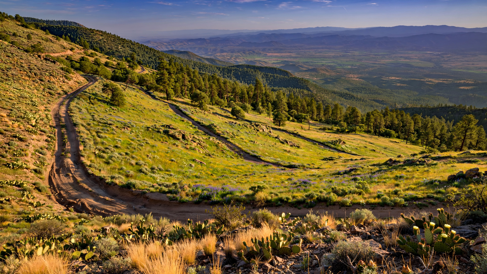
From the floor of the Verde Valley, Mingus Mountain can look like a single dark wall rising above the desert. Climb toward its summit, however, and the landscape keeps changing. Dry grasslands give way to juniper and oak. Oak woodland opens into pine forest. Roadside views stretch across the Verde Valley toward red-rock country, while shaded clearings offer a cooler, quieter version of central Arizona. For related reading, see Arcosanti: How a Yavapai County Desert Experiment Made Architecture a Way of Living.
That transition is what makes Mingus Mountain one of Yavapai County’s most useful places to understand. It is not simply a scenic overlook or a destination attached to the better-known towns below. The mountain is a meeting ground: between desert and forest, working roads and recreational trails, wildlife habitat and human access, and the Verde Valley’s present-day communities and older travel routes. For related reading, see Mingus Lake: The High-Country Place That Gives Yavapai County a Quiet Change of Pace.
A mountain at the edge of several worlds
Mingus Mountain forms part of the higher country between Prescott and the Verde Valley. Its slopes rise sharply from the region around Cottonwood, Jerome, and the lower Verde Valley, creating a noticeable change in climate and vegetation over a relatively short drive. For related reading, see Lynx Lake: The Yavapai County Place Where a Forest Becomes a Shared Backyard.
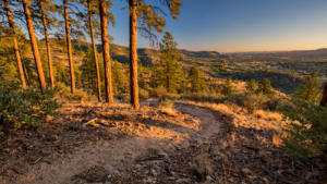
That change is easy to notice even without a field guide. Near the valley, the scenery is shaped by heat, open slopes, cactus, creosote, mesquite, and scattered desert trees. Higher on Mingus Mountain, ponderosa pine and mixed-conifer forest become more prominent. Between those zones are bands of oak, juniper, chaparral, and grassland.
Ecologists often describe such shifts as elevation gradients. For visitors, the scientific idea has a practical meaning: the mountain offers several Arizona landscapes in one continuous journey. The air, light, scent, and pace can feel different from one turn to the next.
The mountain’s elevation also helps explain its importance to wildlife. Forest, woodland, meadow, and rocky slope provide different kinds of cover and food. Birds that favor open country may use the grasslands, while forest species occupy the higher stands. Mule deer, black bear, mountain lion, and other wide-ranging animals can move through the larger forest-and-rangeland landscape, though seeing wildlife is never guaranteed and keeping distance is essential.
The road is part of the experience
Arizona State Route 89A is the best-known route across Mingus Mountain. The highway connects the Verde Valley with the Prescott area and is often treated as a scenic drive, but its deeper value is that it reveals how dramatically the terrain changes across the mountain.
On the eastern side, the road climbs away from the Verde Valley and the historic mining town of Jerome. Curves open onto views across the valley, where broad desert spaces meet the darker profile of distant ranges. Farther west, the forest becomes more continuous before the route descends toward Prescott and the surrounding high country.
Travelers should treat the road as a mountain route rather than a quick shortcut. Curves, changing weather, wildlife, cyclists, motorcycles, and occasional winter conditions all require attention. Pullouts are designed for stopping safely; narrow shoulders and blind turns are not. Checking current road conditions before leaving is especially important during storms, when snow or ice can affect the higher elevations even while the valley remains dry.
The slower approach has its rewards. A journey across Mingus Mountain works best when visitors allow time to stop at legal pullouts, look for changes in vegetation, and notice the relationship between the road and the terrain. The mountain is not a landscape that reveals itself all at once.
A place for camping, walking, and looking closely
The Prescott National Forest manages much of Mingus Mountain and provides several forms of public access, including developed recreation areas, dispersed opportunities, and trails. The Mingus Mountain Recreation Area is associated with forest camping and outdoor use, although individual facilities can have different seasons, rules, fees, and closure conditions.
For a day visitor, the most satisfying activity may be a short walk rather than an ambitious hike. Forest roads and trails pass through pine and oak habitats, cross open slopes, and reach viewpoints where the Verde Valley appears far below. Some routes are gentle; others are steep, rocky, or exposed. A trail that looks manageable on a map can become more demanding because of heat, elevation, loose ground, or a lack of water.
Basic preparation matters. Carry more water than the distance seems to require, wear sturdy footwear, protect yourself from the sun, and download or carry a map because cellular service can be inconsistent. Visitors should also check whether a route is open, whether a fire restriction is in effect, and whether a road requires a high-clearance or four-wheel-drive vehicle.
Camping adds another dimension to the mountain. After the heat and activity of the day, the forest becomes noticeably quiet. The sky is darker than it is in the valley, although the best stargazing depends on weather, moonlight, smoke, and nearby lights. A campfire should never be assumed to be allowed: restrictions can change quickly during Arizona’s dry season, and even a small fire can escape in wind.
Why the forest needs active care
Mingus Mountain’s forests are beautiful, but they are not untouched or self-managing. Like many forests in the Southwest, they have been shaped by decades of drought, insect stress, past fire suppression, recreation, roads, grazing, and changing climate conditions.
Historically, frequent low-intensity fires helped limit the buildup of grasses, needles, branches, and small trees in many ponderosa pine landscapes. When those fires are excluded for long periods, fuels can accumulate and forests can become more vulnerable to severe wildfire. That does not mean every fire is beneficial or that every forest should look the same. It does mean that land managers must balance public safety, habitat, cultural resources, air quality, and the ecological role of fire.
The Prescott National Forest uses a combination of approaches that can include prescribed fire, thinning, road and trail management, monitoring, and public education. The goal is not to make the mountain risk-free. Instead, stewardship aims to make forests more resilient and reduce the chance that a future fire will move through every layer of vegetation at once.
For visitors, responsible recreation is part of that work. Staying on designated routes protects soil and plants. Packing out trash keeps wildlife from associating people with food. Keeping dogs controlled reduces conflicts with wildlife and other trail users. Campers who follow current fire rules help protect the same forest they came to enjoy.
Reading the landscape below the summit
Mingus Mountain also offers a useful vantage point for seeing Yavapai County as a connected landscape. From above, the Verde Valley is not a collection of isolated destinations. Waterways, farms, towns, roads, archaeological sites, and wildlife corridors occupy the same broad valley system.
The mountain’s slopes feed into that system. Rain and snow that fall at higher elevations move downhill through drainages, while forest cover influences how quickly water reaches lower ground. The connection is not always visible, especially in a dry season, but it links the high country to the valley’s rivers and communities.
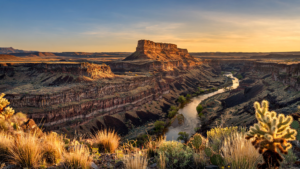
Looking east from a mountain viewpoint can also change how visitors understand the Verde Valley’s famous red rocks. Those formations are dramatic, but they are part of a larger arrangement of plateaus, volcanic remnants, sedimentary layers, forests, and desert basins. Mingus Mountain supplies one of the clearest places to see that arrangement at a human scale.
Planning a responsible visit
Mingus Mountain is accessible in more than one season, but conditions vary sharply with elevation. Summer can be hot on exposed lower slopes and comparatively pleasant in the forest. Autumn brings changing color in oak and aspen pockets, though displays vary from year to year. Winter may bring snow and icy roads at higher elevations. Spring can be green and bright after adequate rain, while also bringing muddy roads and fast-changing weather.
Before leaving, check the Prescott National Forest’s current alerts, road conditions, camping information, fire restrictions, and recreation notices. Do not rely on an old social-media post for access information. Bring water, food, layers, a paper or offline map, and a plan for limited service. If you are visiting a developed campground, confirm whether reservations or fees apply.
Most importantly, make room for the mountain’s quiet. Mingus is valuable not because it offers one spectacular attraction, but because it allows visitors to watch Arizona change across elevation. A few miles can carry a traveler from desert heat into pine shade, from a busy valley to a windy ridge, and from a familiar view to a broader understanding of how Yavapai County fits together.
That continuity is the mountain’s lasting gift. Mingus does not separate the Verde Valley from the high country. It shows how closely the two have always been connected.
Use: Forest geography, recreation access, camping, trail information, alerts, fire restrictions, and stewardship context.
Use: General guidance on recreation planning, responsible use, safety, and changing site conditions.
Use: Travel-planning context for mountain highways, changing conditions, and road-safety guidance.
Use: Background on Arizona wildlife habitat, responsible wildlife viewing, and keeping distance from wild animals.
U.S. Forest Service — Prescott National Forest — https://www.fs.usda.gov/prescott — Forest geography, recreation access, camping, trail information, alerts, fire restrictions, and stewardship context.
U.S. Forest Service — National Forest System lands and recreation information — https://www.fs.usda.gov/visit — General guidance on recreation planning, responsible use, safety, and changing site conditions.
Arizona Department of Transportation — Arizona road conditions and travel information — https://azdot.gov/projects/roadway-information — Travel-planning context for mountain highways, changing conditions, and road-safety guidance.
Arizona Game and Fish Department — https://www.azgfd.com/wildlife/ — Background on Arizona wildlife habitat, responsible wildlife viewing, and keeping distance from wild animals.